
What EASy2 reads
- NetCDF (versions 3, 4 and 5) and HDF5, with their own units, scaling and missing values. A file with many time steps, variables or depths shows each as its own image.
- HDF4: the older NASA ocean color and wind archives, such as SeaWiFS, MODIS and QuikSCAT.
- GeoTIFF: satellite pictures and GIS rasters in latitude and longitude, UTM or Web Mercator, including cloud-optimized files and aerial photographs.
- Ocean models on regular grids, on curved grids (ROMS and CROCO, for example) and on terrain-following layers, which EASy2 shows at fixed depths.
- Model meshes: the output of FVCOM and of DHI MIKE 21 and MIKE 3 models, drawn from the model's own triangles at depths below the moving surface and just above the sea floor, without regridding and without DHI software.
- True color: red, green and blue bands, such as Sentinel-2, Landsat and NASA's daily pictures, show as they would look from space.
Currents show as vector arrows, colored by speed if you like, and can be laid over a second and third image, such as temperature.
Downloading imagery
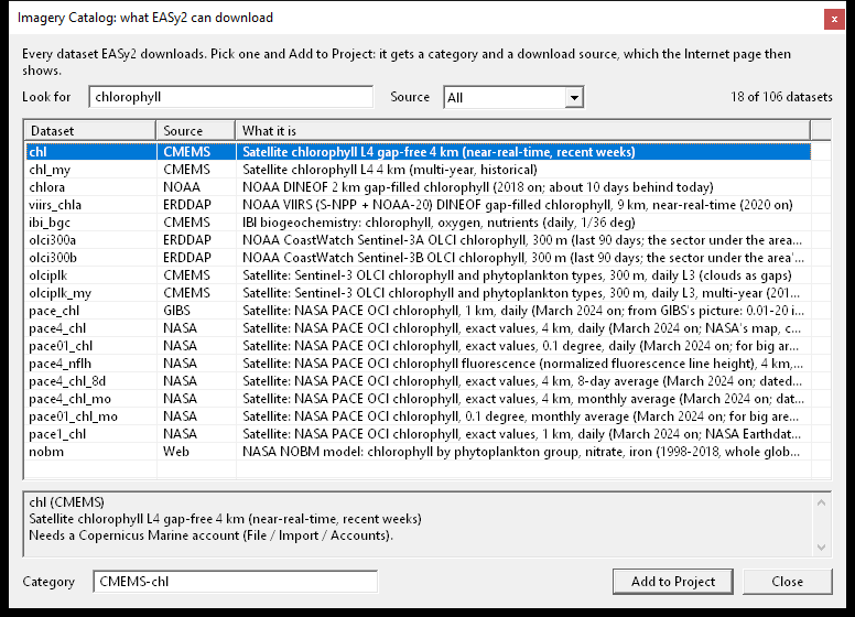
EASy2's catalog lists more than a hundred datasets it can download, with a search box. Pick one, draw the area on the map, give the dates, and EASy2 downloads the files and adds them to the project as a new image category. The catalog includes:
- Copernicus Marine global and regional ocean models (currents, temperature, salinity, sea level, oxygen, nutrients, plankton, waves) and satellite products.
- NOAA gap-filled chlorophyll and the 300 m Sentinel-3 chlorophyll from CoastWatch.
- NASA PACE ocean color, MUR sea temperature, daily true-color pictures, vegetation, land temperature and rain.
- Sentinel-2 true color at 10 m.
Many of these need no account. For those that do, such as Copernicus Marine, the free logins are kept by Windows, never in a project or an installer.
Keeping imagery up to date
A download can repeat by itself, every few hours or at a set time each day, even when EASy2 is closed. A forecast category can keep a rolling window of days, from a few days back to a week ahead, and each day's forecast is replaced by the service's newer run. Each project keeps a record of every day downloaded, or why a day failed.
For a single place, such as a farm site or a buoy, EASy2 can fetch the values over time straight from Copernicus Marine or NOAA, as a table, without downloading the images.
Checking and moving imagery
- Update Imagery finds the new files waiting in a category's folders and adds them.
- Check Imagery looks for images that came down damaged at the source, and fetches them again.
- A project names its imagery by folder, so on another computer it only needs to be told where those folders are. Images that came from the project's download sources can be downloaded again there.