|
|
|
|
|
|


 |
|||
| Product Main Page | |||
| Key Features | |||
| System Requirements | |||
| Documentation | |||
| Downloads | |||
| Support | |||
EASy 3.50
Key Features
- Specifically designed for marine applications
- Instant web deployment
- Access to spatial and temporal dimensions
- Relational database-driven environment
- Advance modeling functionality and data analysis tools
- Handles a wide variety of oceanographic data formats
Specifically designed for marine applications
EASy is an advanced, PC-based geographical information system designed for the storage, integration, analysis, dynamic display, and dissemination of spatially referenced series of diverse oceanographic data. It has been used in a range of national and international oceanographic projects.
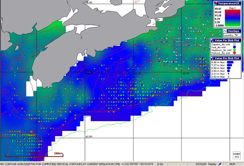
EASy in action - renders fisheries survey data into bubble charts, overlayed with satellite imagery for sea surface temperature
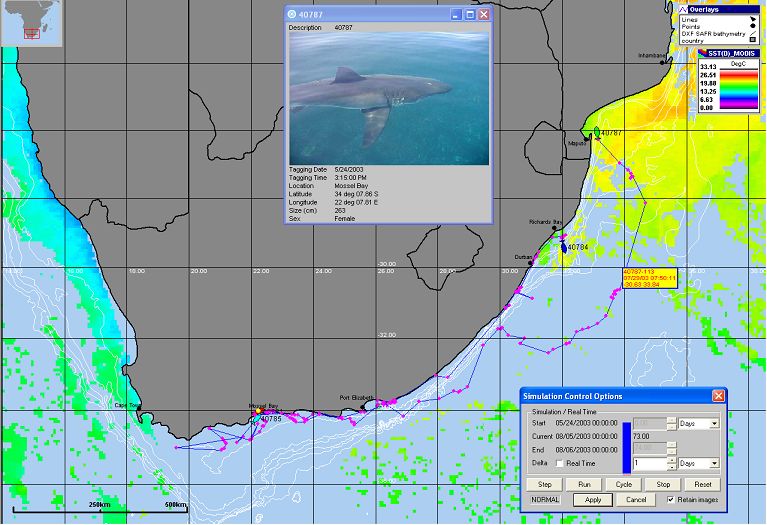
Interactive display of tracks for a tagged Great White Shark off South Africa
